Harnessing the High-Head Potential of the Tila River
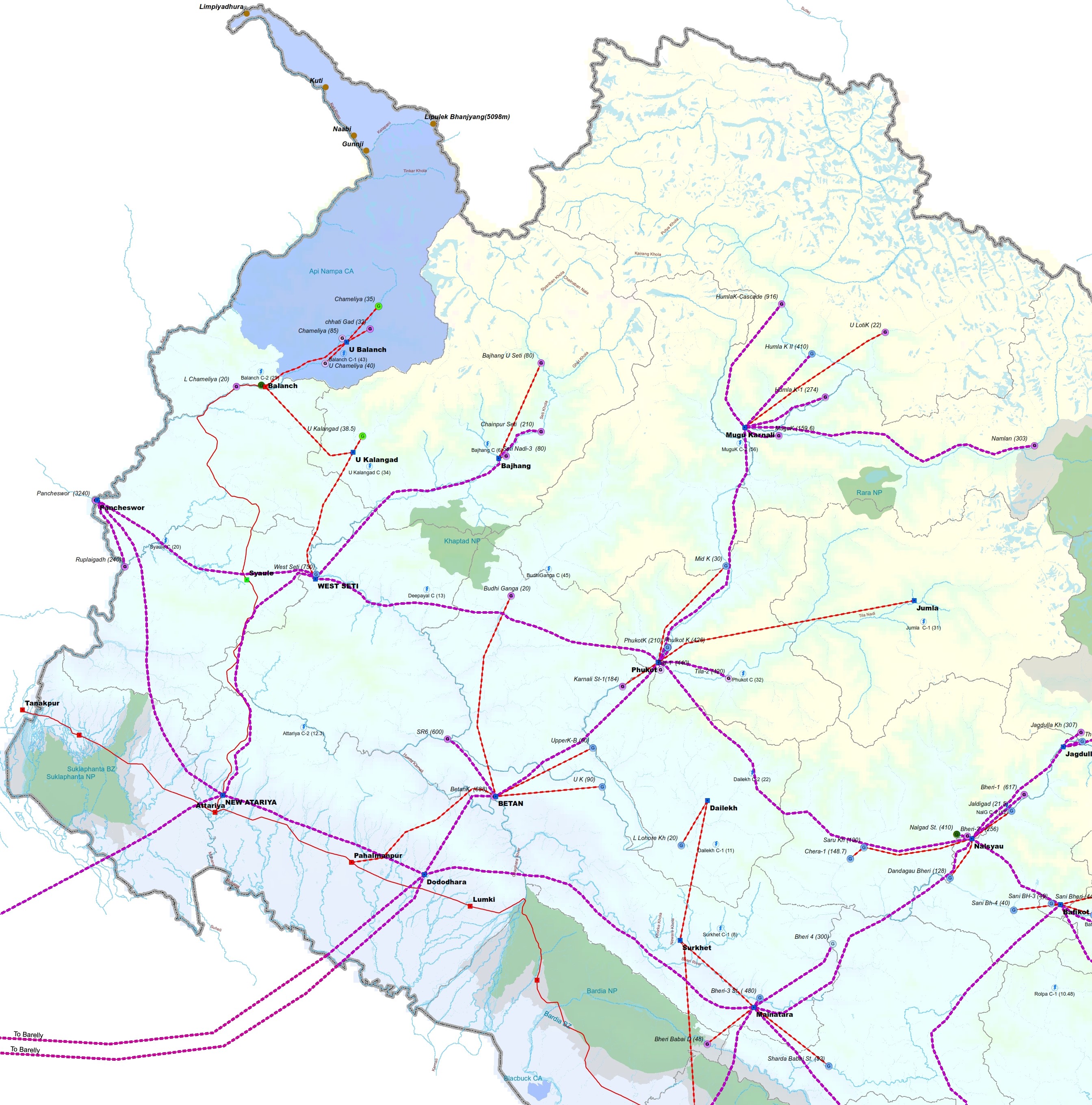
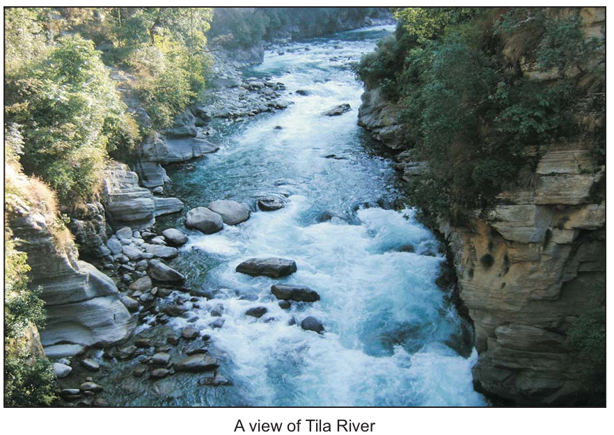
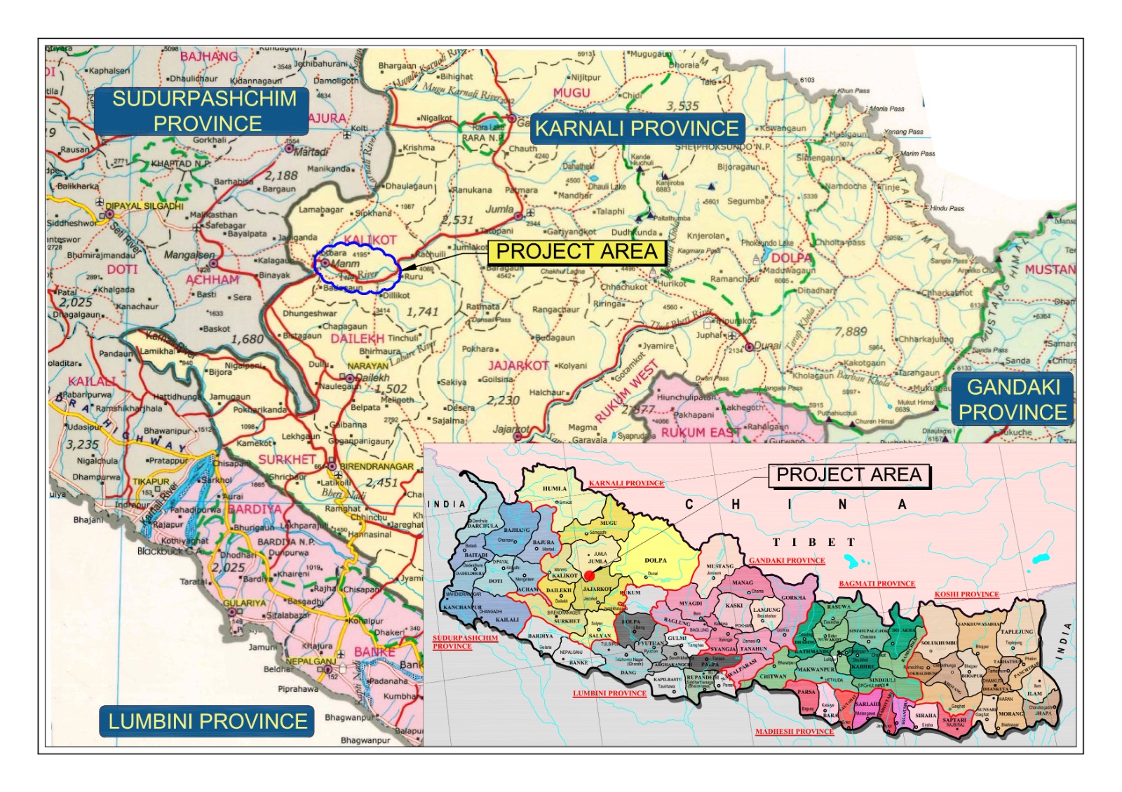
The project is located on the Tila River, one of the major perennial tributaries of the Karnali River basin in western Nepal. The dam axis is situated just downstream of the confluence between the Tila River and Ruru Khola at latitude 29°06’00” N and longitude 81°44’38” E.
The catchment area of the river at the intake covers 3,355 km², benefiting from both monsoon precipitation and significant snowmelt contributions from the high Himalayan ranges (permanent snow line above elevation 4,500 masl). This dual hydrological feed guarantees sustained dry-season discharges.
The underground powerhouse is situated on the right bank upstream of Serighat Village (latitude 29°10’00” N, longitude 81°52’00” E), utilizing a gross head of ~510.5 meters and a rated net head of 468 meters.
Key Waterway & Civil Infrastructure Scheme
The project layout incorporates cutting-edge underground civil engineering designed to withstand Himalayan geological conditions:
- • Concrete Gravity Dam & Spillway: An 182.4-meter-long, 55-meter-high concrete gravity dam creates a 1.7 MCM live storage reservoir for 6 hours of daily peak generation. Equipped with 7 radial spillway gates (7.7 m × 13.5 m) designed to handle 1-in-10,000-year floods.
- • Dual Desilting Basins: Two Dufour-type desilting chambers (12 m × 18.8 m × 290 m each) efficiently extract abrasive quartz sediments coarser than 0.20 mm to safeguard turbines.
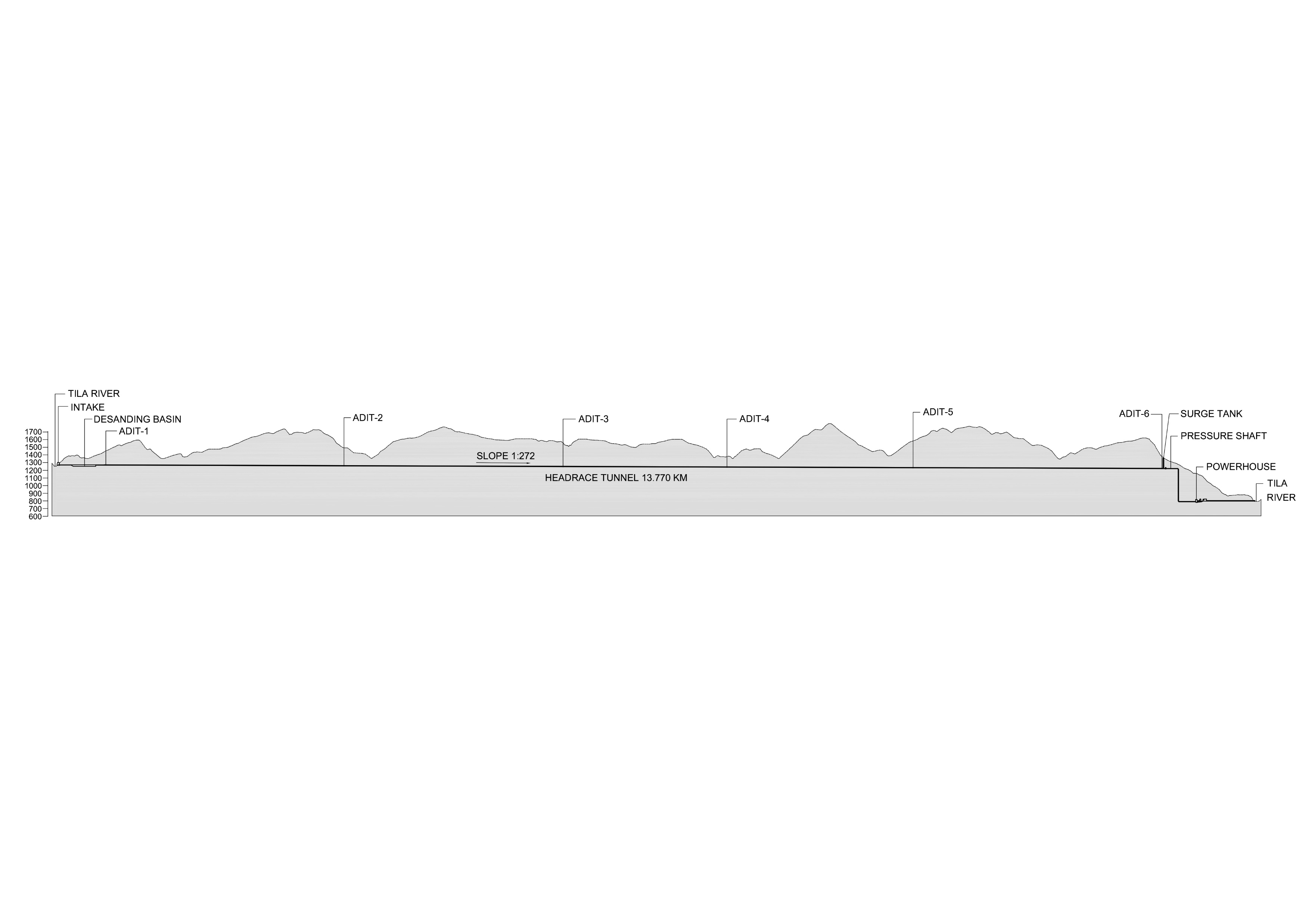
- • 13.77 km Headrace Tunnel (HRT): Concrete-lined modified horseshoe tunnel (6 m internal diameter) excavated via 6 strategically placed construction adits for rapid multi-face progress.
- • Surge Shaft & Steel Penstocks: A 128-meter-high open-to-sky surge shaft (10 m dia.) connects to twin steel pressure shafts (846 m and 816 m) splitting into 4 high-pressure penstocks.
- • Underground Powerhouse: Machine hall cavern (18.5 m × 69.5 m) housing 4 high-efficiency Pelton turbine units of 110 MW each, generating 440 MW of clean capacity (PPA capacity: 298.75 MW).
Strategic Road Access via Karnali Highway
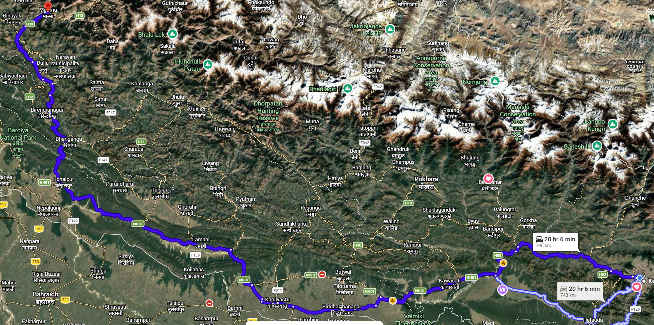
The project site is connected to Nepal’s national strategic highway network through the paved Karnali Highway (H13). All heavy electromechanical and hydromechanical shipments can be transported directly from the Nepalgunj border customs dry port to the project site:
| Route Segment | Distance (km) | Road Condition & Infrastructure |
|---|---|---|
| Kathmandu – Nepalgunj | 519 km | Paved East-West National Highway (H01) |
| Nepalgunj – Surkhet | 110 km | Paved Ratna Highway (H12), regional logistics center |
| Surkhet – Manma (Kalikot) | 150 km | Paved Karnali Highway (H13), project district headquarters |
| Manma – Dam Site (Headworks) | 20 km | All-weather feeder access road along the river corridor |
| Total Logistics Corridor | 799 km | Direct heavy freight access from customs to project adits |
Evacuation via 400 kV Karnali Corridor Transmission Line
The electricity generated by the 4 Pelton turbine-generator units will be stepped up from 11 kV to 400 kV via thirteen single-phase 29.5 MVA generator transformers. Power will be evacuated via a dedicated 6-kilometer 400 kV double-circuit transmission line to the Rastriya Prasaran Grid Company Ltd (RPGCL) Phukot Hub Substation.